I disagree. While the original is far more comprehensive and interactive, this map is a superior visual summary for the same reason the original London tube map was so revolutionary - it allows you to see the layout of the network without geography getting in the way (not an obvious thing to do at the time). I for one, despite having looked at many such cable maps, have never managed to grasp the actual topology of the internet.
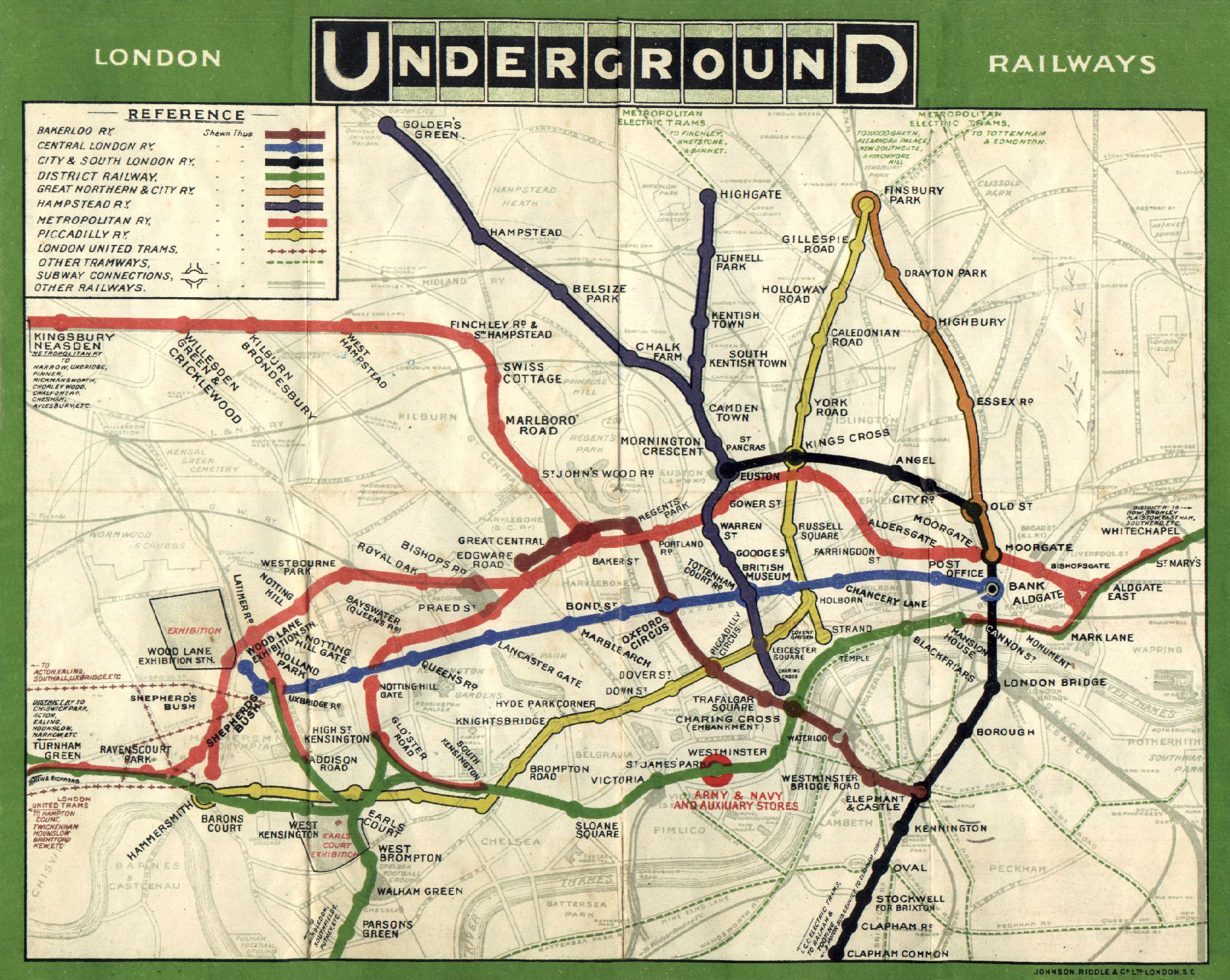
There are far cleaner geographic tube maps than that, and if you want to have any idea of where you are in London the geographic tube map is the one to use. The designed map is very clean and clever but eliminates all information except the list of stations per line, which is no use when you want to relate those stations to places where time and distance matter. You can get out at station A, walk to your final destination only to find a closer station that the map gives no indication of. It's simplistic to the point of misleading. Some people have brought out maps indicating walking distance between stations in an attempt to fix a fundamentally unsuitable map. Tinkering. The complete lack of character in a straight line also makes locations harder to remember - I need to change on the straight line with a station called arbitrary name vs I need to change at the kinky curve. The current map is great, but it should hang in a museum.
That map does seem pretty useful, it's certainly easier to figure out if it's quicker to walk somewhere(sometimes what looks like a long route on the tube can actually be a 10/15 min walk). Bear in mind that there's far more information on the modern map though. There's additional tube lines (e.g. jubilee, victoria, and the whole DLR) and it covers a far greater area of London.
Ain't it funny that none of the cables actually drop into Silicon Valley. Most of the Northern California cables drop near Morro Bay or San Luis Obispo instead.